Driving Directions from Calgary
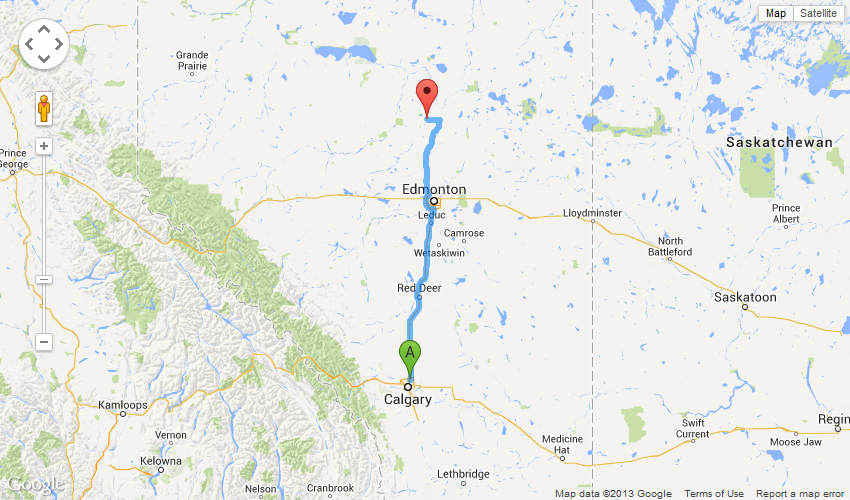
| 2000 Airport Road Northeast, Calgary, AB T2E 6Z8, Canada |
443 km - about 4 hours 28 mins
| 1. | Head southeast on Airport Rd NE | 800 m | |
| 2. | Turn right to stay on Airport Rd NE | 350 m | |
| 3. | Turn left onto Barlow Trail NE N | 650 m | |
| 4. | Turn left onto 96 Ave NE/Airport Trail NE W | 1.8 km | |
| 5. | Merge onto Deerfoot Trail/AB-2 N via the ramp to Deerfoot Trail Continue to follow AB-2 N |
269 km | |
| 6. | Take the Anthony Henday Drive exit on the left | 2.0 km | |
| 7. | Merge onto AB-216 W | 29.1 km | |
| 8. | Take exit 31 for Alberta 2/Saint Albert Trail toward Mark Messier Trail | 750 m | |
| 9. | Turn left onto St Albert Trail | 7.5 km | |
| 10. | Continue onto AB-2 N | 53.9 km | |
| 11. | Turn right onto AB-18 E (signs for AB-2 N) | 1.8 km | |
| 12. | Continue onto AB-2 N | 55.1 km | |
| 13. | Turn left onto AB-663 W | 15.4 km | |
| 14. | Turn right onto Township Rd 650 | 2.4 km | |
| 15. | Township Rd 650 turns right and becomes Range Rd 250 | 1.1 km | |
| 16. | Continue onto Township Road 650A | 350 m | |
| 17. | Turn left onto Township Road 650B | 250 m | |
| 18. | Continue onto Township Road 650A | 210 m | |
| 19. | Continue onto Township Rd 651 | 500 m | |
| 20. | Turn right Destination will be on the right |
150 m |
| Township Road 651, Colinton, AB T0G 0R0, Canada |
Updated December 02 2013 by AU Geophysical Observatory