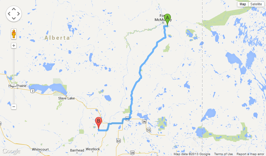
Driving Directions from Fort McMurray
| Airport Road, Fort McMurray Airport (YMM), Fort McMurray, AB T9H 0B6, Canada |
340 km - about 3 hours 43 mins
| 1. | Head north | 18 m | |
| 2. | Slight left toward Airport Rd | 60 m | |
| 3. | Turn right onto Airport Rd | 82 m | |
| 4. | Turn left to stay on Airport Rd | 350 m | |
| 5. | Turn right onto Township Road 884A | 1.7 km | |
| 6. | Continue onto Township Road 884B | 1.6 km | |
| 7. | Turn right onto AB-69 W | 4.0 km | |
| 8. | Turn left onto AB-63 S | 241 km | |
| 9. | Turn right onto AB-55 W (signs for Boyle/Edmonton) | 22.8 km | |
| 10. | Turn right to stay on AB-55 W (signs for Athabasca) | 31.5 km | |
| 11. | Turn left onto 50 St/AB-2 S Continue to follow AB-2 S |
13.8 km | |
| 12. | Continue straight onto Township Road 650 B/AB-663 W Continue to follow AB-663 W |
2.7 km | |
| 13. | Turn right to stay on AB-663 W | 15.4 km | |
| 14. | Turn right onto Township Rd 650 | 2.4 km | |
| 15. | Township Rd 650 turns right and becomes Range Rd 250 | 1.1 km | |
| 16. | Continue onto Township Road 650A | 350 m | |
| 17. | Turn left onto Township Road 650B | 250 m | |
| 18. | Continue onto Township Road 650A | 210 m | |
| 19. | Continue onto Township Rd 651 | 500 m | |
| 20. | Turn right Destination will be on the right |
150 m |
| Township Road 651, Colinton, AB T0G 0R0, Canada |
Updated December 02 2013 by AU Geophysical Observatory